
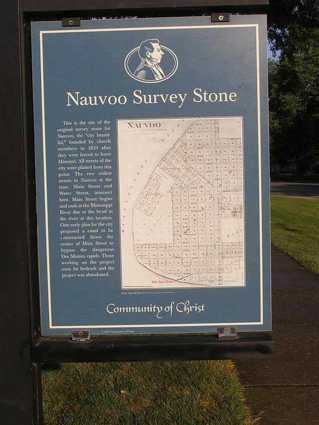
At the South West Corner of Mainstreet and Water Street you can see a small stone on the sidewalk marking the survey stone of Nauvoo. This is similar to the way the Saint intended to set up Independence Missouri in 1833.
The Nauvoo streets were to run along four main points of the compass.
The City blocks contained four lots of one acre each. In the original city plans each lot was to only have one home, set back 25 feet from the street. Nauvoo grew larger than anticipated the one house lots were subdivided into more lots to accommodate more people.
The Nauvoo city streets were to be 49.5 feet wide, with the exception of Main Street. Main Street was to be almost double the size at 82 feet wide to accommodate a two mile canal that was planned to run from river to river to provide shipping, wharfs, water power, and industry. This canal was never built.
The Saints were forced to leave Nauvoo before all their plains could come to life.
p 134 Nauvoo Tour book